Choosing the Route
I don’t exactly recall how we landed on the Grand Canyon as our hiking destination, but I do remember basing it loosely on the expectation of warm(ish) weather. Since we were planning a February trip, we set our sights on the Southwestern US. I had never been to the Grand Canyon, let alone inside of it, and didn’t know much more than what you would expect from your average American – it was a giant beautiful canyon with the Colorado River running through it.
As we started researching route options to make an itinerary, accepting that we were completely unfamiliar with the area, we relied heavily on the Grand Canyon National Park Service (NPS) website for information and maps. The NPS website could tend to be frustrating and difficult to navigate, but for us it was a good start and helped give us direction as we sought out other resources.
What we learned right away is that the North Rim, arguably the most popular side of the canyon, is closed in the winter due to dangerous road conditions. This left the South Rim option open to us which has two trails going down to the bottom of the canyon, the South Kaibab Trail and the Bright Angel Trail. Both end at Bright Angel Campground – the most well-known and traveled campground in the canyon.
We wanted to spend 4 nights inside the canyon, so we started researching other trail options to take once we got down there. Alex found a good recommendation on AllTrails of the Clear Creak Trail. The Clear Creek Trail is an out and back trail that runs (roughly) east/west along the Colorado River from Bright Angel Campground to Clear Creek. At this discovery, we solidified our itinerary!
Day 1: South Kaibab Trail to Bright Angel Campground
Day 2: Clear Creek Trail to Clear Creek
Day 3: Free day at Clear Creek
Day 4: Clear Creek Trail to Bright Angel Campground
Day 5: Bright Angel Trail back up to the top of the South Rim


Preparation
Along with the NPS website, AllTrails, and Google, I also called the Grand Canyon Backcountry office several times during the planning phase. I found them to be super friendly and helpful and they answered all of my questions thoroughly! We got most of our information from internet research, but I always appreciate first hand experience.
A backcountry permit is required to stay overnight in the Grand Canyon. We applied for our permit about 3 months prior to our February start date and were approved pretty quickly, I think within a couple of weeks. The NPS has a system for how they field permit requests and it can be difficult to get a permit during the busy season (spring through fall), but a February hike is not as desired.
A few things I sought advice on from the backcountry office:
- Our chosen route. When you apply for your permit, you apply for where you will be camping and for how many nights. I called the backcountry office to get their opinion on our chosen route, and their support made me feel a lot better about our itinerary.
- Spikes. I was reading a lot about ice on the trails in the winter and the necessity of spikes. The rangers suggested that it was better to have them and not need them than need them and not have them. We took their advice and bought some “microspikes” from REI that fit over our hiking boots. And even though we didn’t use them often, we were glad that we had them.
- Food storage. While Bright Angel Campground had food storage boxes, we would be on our own for food protection at Clear Creak. The park rangers warned us about how aggressive the rodents in the canyon can be when trying to get to food, and I don’t mess around when it comes to eating on the trail. My trail food is too precious to leave unprotected! They advised either bear canisters or rat sacks. We decided on rat sacks, mainly because bear canisters are so heavy.
- Weather. As our start date approached, I kept a close eye on the weather. With the weather app on my phone, I was looking at the Grand Canyon Village temperatures. I started getting nervous as I saw the lows at night getting down to single digits! While we could hold our own at around freezing temps, we were not equipped for 9 degrees Fahrenheit. The rangers informed me that it is actually much warmer in the canyon, and that you can count on about 5 degrees warmer for every 1,000 feet of elevation loss. Our campground was about 4,000 feet lower than the village, so we could expect the low to be at about freezing (20 degrees warmer in the canyon than the top of the rim). Not exactly warm, but manageable! I was advised to use “Phantom Ranch” in my weather app for a more accurate temperature expectation.
Day 1 – South Kaibab Trail to Bright Angel Campground (7mi)
We flew into Las Vegas the night before starting our hike, so we spent the night in Kingman, AZ (about 1.5 hours from the airport and 2.5 hours from Grand Canyon Village). We tried to start our day early, but a calamity of errors (purely by our own design) got us into the village around noon. These errors included but may not be limited to: hitting a bright yellow concrete pylon with the rental car, spending 30 minutes searching for Alex’s lost wallet, and spilling my entire reservoir full of water all over the back car seat. We were a mess. I digress.
When we got to Grand Canyon Village, we parked our car (for free) at the Backcountry Information Center. There, we checked in with the rangers, used the restrooms, and hopped on the village bus that goes through the park – it took us right to the South Kaibab Trail Head. The views from the top were already incredible and we were excited to get the hike started after a weird morning and long drive!
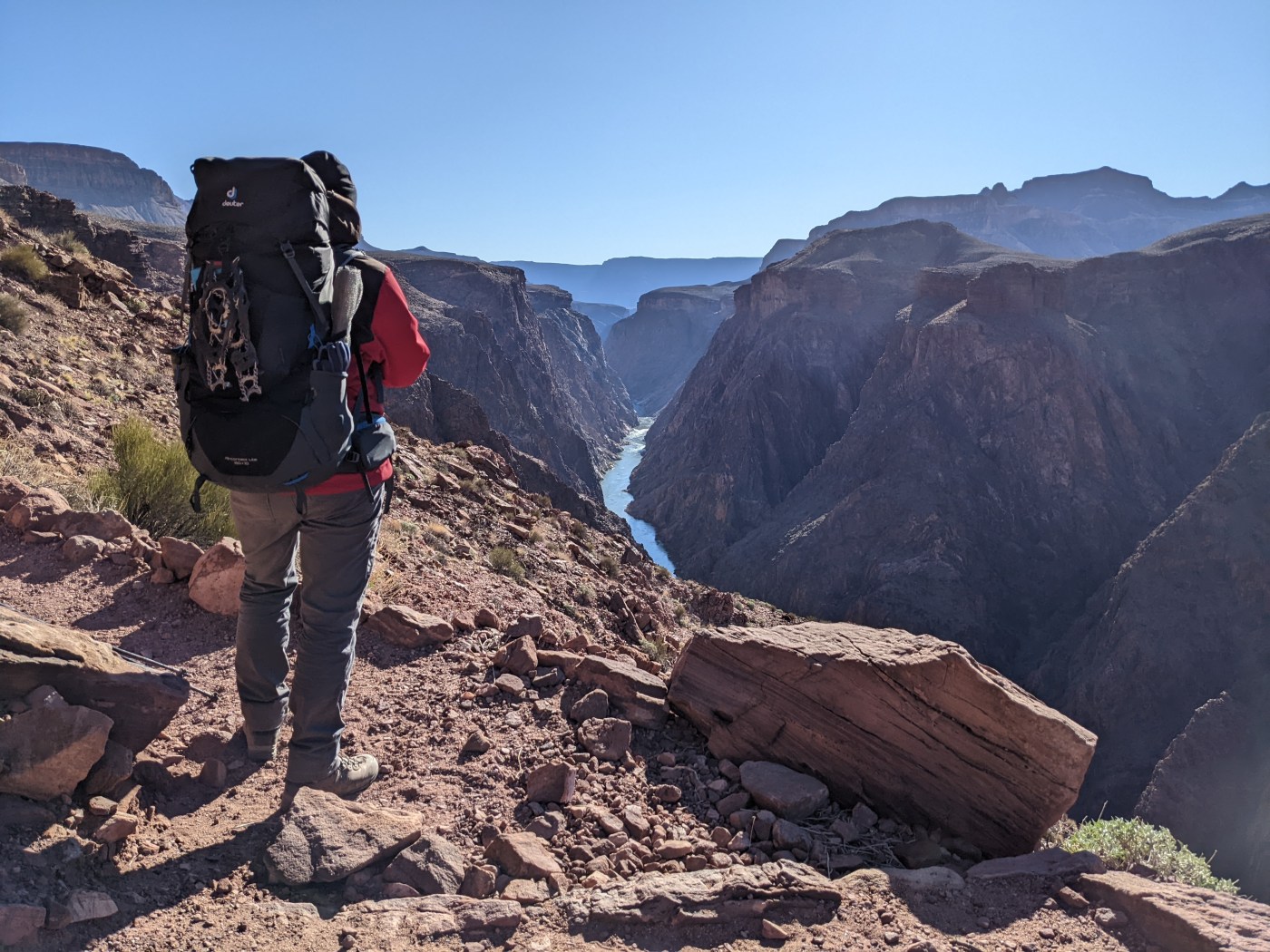
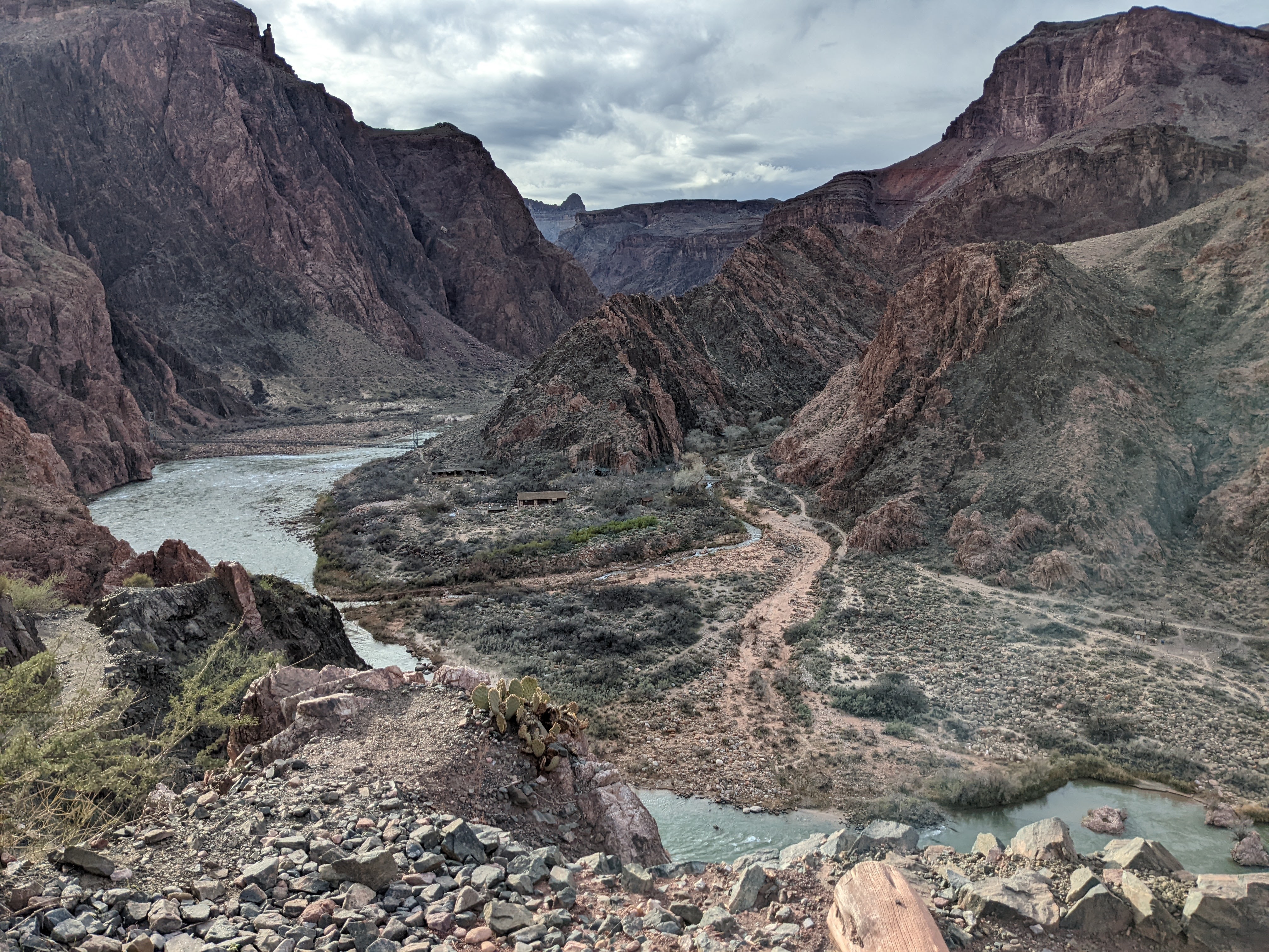
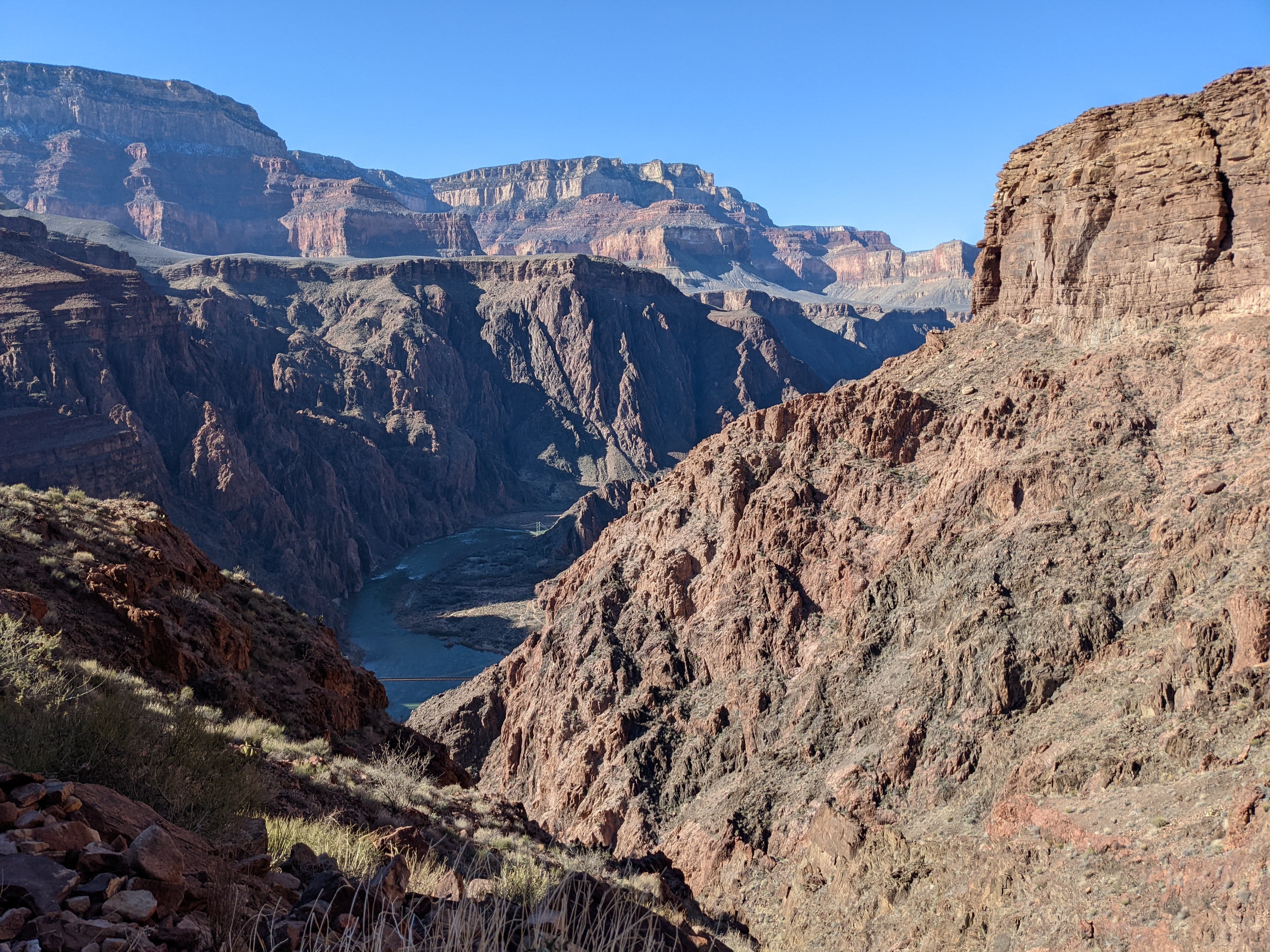
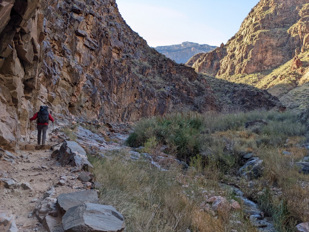
The hike down was spectacular, another incredible view around every corner. Since we got a late start, there were very few people hiking in the same direction so it felt much more remote than I was expecting. We did pass quite a few day hikers on their way back up, but after a couple of miles, that thinned out considerably. We ended up making it down to Bright Angel Campground in less than 3 hours. The campground is situated at the junction of Bright Angel Creek and the Colorado River and the descent into the campground is really a beautiful sight.
As we walked through the campground, a couple of things surprised us. One, there were very few people there – we had plenty of sites to choose from. And two, the campground itself is very developed. There were several spouts for potable water, a bathroom with *flush* toilets, a sink for dishes, and even a canteen to buy snacks and hot meals! There are several cabins at Phantom Ranch (just past the campground) that seem to be the frequenters of the canteen. The campground host said they get their food deliveries by mules and helicopters…both of which we saw.
We got situated at our site, emptied all of our “smelly” belongings (food, toothpaste, etc.) into the provided food box at our site, and hung our bags on the provided poles. They suggest that you completely empty your backpack and hang it with all of the zippers open to avoid critters chewing through it. I did exactly that – I didn’t want to take any chances! After scarfing a ramen and beef jerky dinner, we were ready to crash. It got dark very early, and once the sun set the temperature dropped quickly. They don’t allow campfires in the canyon, so we found ourselves in our tent by around 7pm every night! The nights were cold, but not unbearable – I believe the low was right around freezing, just about as cold as our equipment could take.


Day 2 – Clear Creek Trail (9mi)
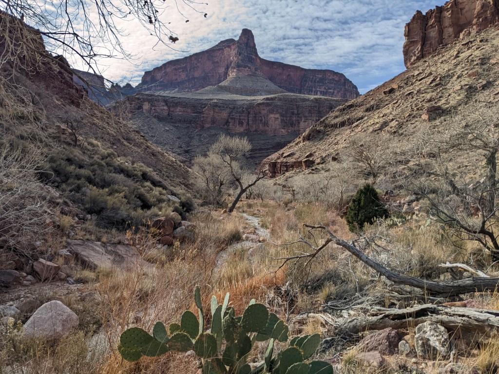
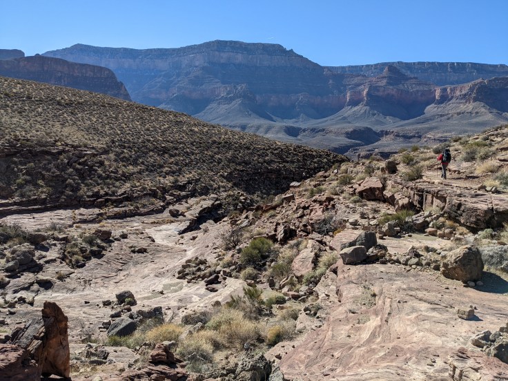
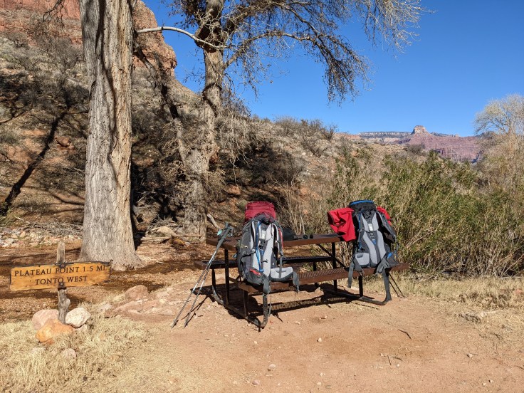
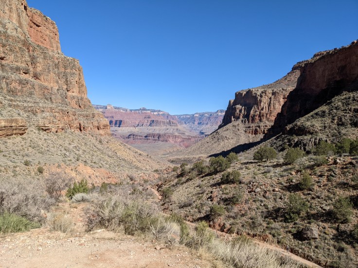
With an early start the next morning we made our way to the start of the Clear Creek Trail, about three-tenths of a mile past Bright Angel Campground. We took this trail East along a ridge that roughly follows the Colorado River along the Tonto Platform. After an initial steep hike up, the rest of the hike had very little elevation gain/loss and we were met with spectacular views of the river into the canyon. The hike was fully in the sun – there was zero shade from start to finish and no water sources along the way. While we we welcomed the warmth and it made for perfect hiking weather in February, it would have been a dangerous trek in the summer.
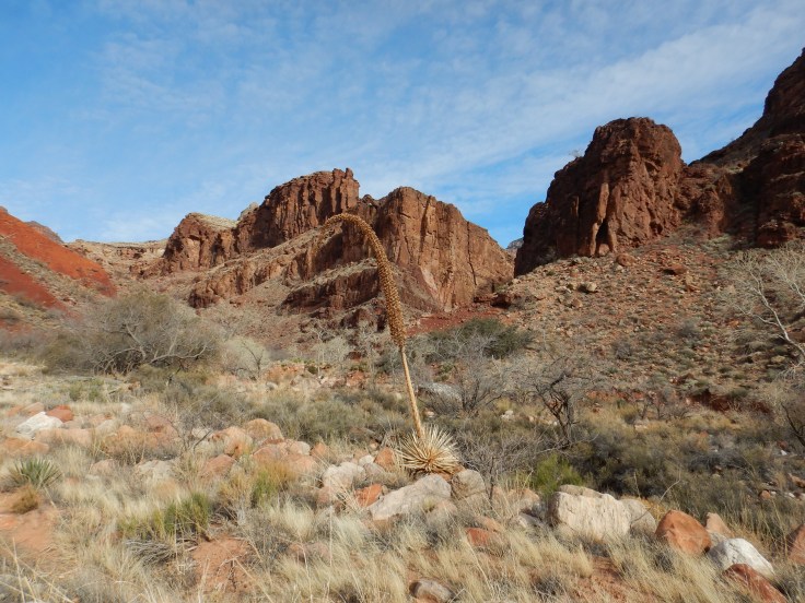
We saw only one hiker on our way to Clear Creek and he was heading in the other direction. The seclusion made the hike feel almost surreal. As the trail meandered across Tonto platform, we were met with views of the sandstone tapeats, as well as several washes and drainage areas. Before we left the campsite that morning, the host warned us that when we felt like we were almost there that meant we were about halfway. We understood his warning as the winding path was deceptively longer than it looked to the naked eye.
As we eventually neared the end, we were met with a sketchy descent down to Clear Creak on a ground of flaky shale. I am generally not afraid of heights, but there were times during this descent that I was white-knuckling my trekking poles and willing myself not to look down. Luckily the descent was comparatively short! After the descent, there is a short path to the creek which passes right by a door-less open-air vault toilet – yes, you read that correctly. Beware of your timing.
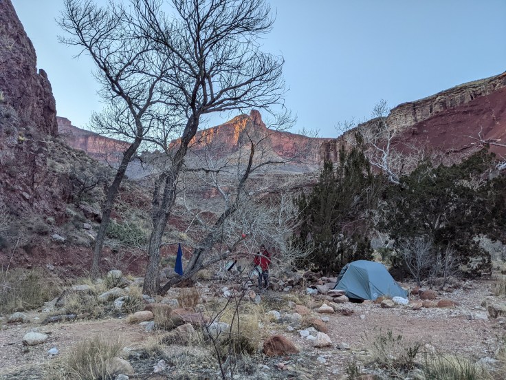
We got to the creek, setup camp, and it quickly became clear that we would be the only campers there for the night. What a treat.


Day 3/4 – Rest Day & Return to Bright Angel
We planned on staying two nights at Clear Creek, so we had a day to do as we wished without packs on our backs. From Clear Creek, there is the option of hiking down to the Colorado River and back – approximately 12 miles round trip – but we opted for a day of relaxation. We explored the area, chased the sun, and marveled at the feeling of having the whole place to ourselves.
The next day, it was back to Bright Angel Campground. As the Clear Creek Trail is an out-and-back trek, we made our way back the same way we came in. The hike felt just as spectacular but seemed to go much quicker. We setup camp at Bright Angel for our last night in the canyon.


Day 5 – Bright Angel Trail up to South Rim (9.5mi)
There are two trails that descend into Bright Angel Campground from the South Rim: South Kaibab Trail and Bright Angel Trail. Since we took South Kaibab down, we thought we may as well take Bright Angel up. The first half of the trail went relatively quickly with a very gradual elevation gain. While I was enjoying the relaxed hike, I knew this incline was not going to get us to the top in less than ten miles.
With about five miles to the top, the climb really kicked in. It demanded a slow, steady march. As we got closer to the top, the trail became covered in a thick sheet of ice – enter spikes! I have never been so happy with my own over-preparation. We saw several people take hard falls and those are difficult to recover from when you are exhausted and carrying 25+ pounds on your back. The climb to the top was absolutely exhausting and was a challenging end to the trip, but the feeling when we reached the South Rim was incredible!


Leave a comment